Wheat Aerials 2014
After a one hour flight in this:


where I was harnessed and tethered, I headed back to the motel in mid day heat to work the files, of which there were 437.
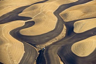
Here are a few from today's shoot in the Palouse in eastern Washington:


 The yellow is Canola.


Chalking those up to being nice but a little insignificant? Think they don't hold up that well on your iPhone screen? Well, this is a crop of the barn in the lower right from a print size of 30 inches (at 245 pixels per inch):

meaning that these will be amazing. Can't wait to see them as prints. One of the all time best aerial shoots ever for me. Calm air, wonderful clarity, temp in the mid 60's, doors off the plane, no wing strut in the way. The 206 Cessna I used cost a little more but was really worth it.


Part of what's so wonderful about being a photographer is the opportunity it affords you to do things that are different than what most people do. You know I am all about the pictures, the results I get, but there is also the ability to have such wonderful experiences too.
This as I took a break from pointing down at 1000 feet above the Palouse:

When I get home and begin to work the files I will post Wheat 2014 on the site.
Want to know more about photographing aerially?
Go here:
and
Thanks for reading this blog! I hope you enjoy it.
Related series
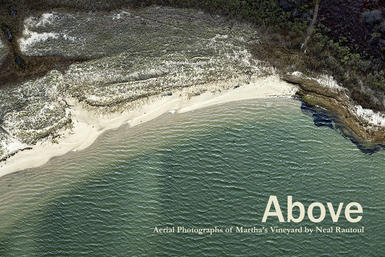
Above
A book of aerial photographs of the island of Martha's Vineyard.
Currently out of print
This exceptional book looks at the unique topography of the island from a view above. With over 40 pages of exquisite color photographs, and an introduction by Patrick Philips, the editor and publisher of the magazine MV Arts and Ideas, this new book shows us an island very different than the one we see coming in on the ferry or as we relax on the beach. The photographs were taken in the spring and fall of 2012.
15 x 11.5 inches in full color. This limitied edition book is available from the author. Please contact Neal Rantoul at: nrantoul@comcast.net to order. $100 plus shipping. Ordered books take about two weeks to arrive.
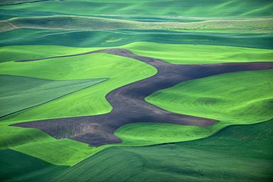
Wheat, Washington 2010
I have been photographing in this southeastern corner of Washington for over fifteen years. The area, called “The Palouse” is hundreds of square miles of wheat, lentils, safflower. etc. I first began making pictures here in black and white 8 x 10 in the 90’s, then added color in 2000, beginning to work aerially about the same time and now make all my pictures digitally. I also return in different seasons as the landscape changes drastically depending on what stage the crops are in. As there is so much work from this area, we have chosen to show work from several different trips or shoots and to change them out from time to time. The group shown here is from a trip I made in August 2010.
Wheat, Washington 2009
These photographs were made on a trip to the Palouse area in Washington in June 2009.
The area is at its greenest then.
I have been photographing in the region every year since 1996. Since about 2006 I have been combining the work made on the ground with aerial work.
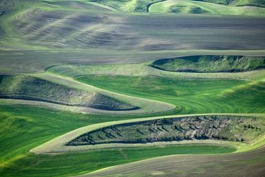
Wheat, Washington 2011
This is the third of the bodies of work from the southeastern corner of the state of Washington called "The Palouse" represented on the website. As I write this now in August, 2012 I am working on a new group from a trip made in late July.
The photographs from this 2011 trip were made in mid May, a very different time in the region. It is very early in the growing season and the crops are either just showing bright green or are still turned under from the previous winter and are bare. There are also some fields that are the stubble remaining from the previous harvest in the fall.
As usual, I stayed about a week and photographed from the air as well as on the ground.
We will post the new 2012 wheat field pictures soon.


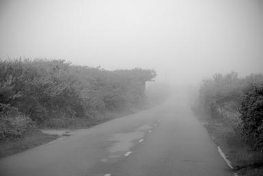


 Cohesion? Not yet, it is still early days. Right now, I am trying to figure out if I have a real project yet. The plan is to continue along Route 2 until I get to the western edge of the state. So far I have shot about 1/3 of the road's length.
  This is one of the planes I fly in, piloted by Mike, who is part of an outfit called "


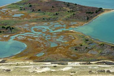
 As we approached the landing strip back in Katama. we flew over a couple of ponds:

 Martha's Vineyard is a special place and fragile in many ways. Let's hope we don't screw it up so that it can be like this, so very beautiful, for future generations.